Handling the risks of landslides
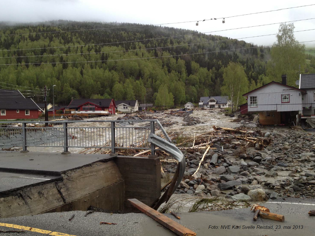
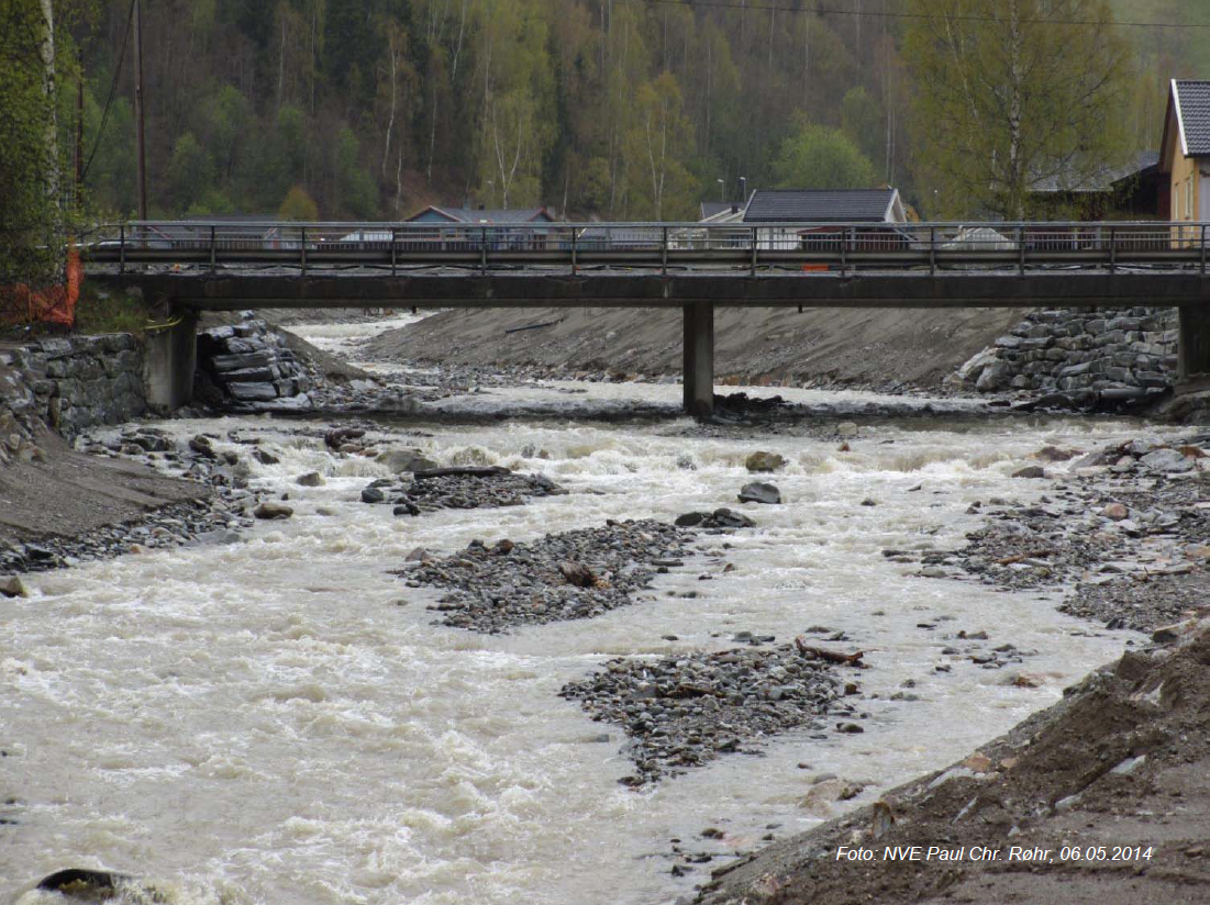
Innovations in risk management of landslides range from characterising physical processes in landslide occurrence and mitigation works to measurement of perceptions among technical experts and stakeholders. The characterisation of the initiation of landslides and the systematic collection of related datasets are key aspects for risk characterisation. Both topics have been at the centre of the task on numerical and analytical methods for landslides. A physically-based model for landslide initiation was applied to the Veikledalen basin (north of Kvam, Gudbransdalen) in order to simulate the incidents that occurred at the end of spring in 2011 and 2013, which caused extensive damage in infrastructure and buildings. The results of the model were compared with actual observations in a database that was completed as part of the activities of Klima 2050 in collaboration with NVE, Statens Vegvesen and Jernbaneverket. This database is so far the most complete event-based inventory in Norway for landslides triggered by water and is a valuable contribution to development and innovation within the field.
Reduction of landslide risk can be achieved using a wide range of mitigation measures. However, these measures have to be technically suitable (e.g., depending on the type of landslide and the availability of construction technologies) and socio-economically feasible. Therefore, the selection of alternatives depends on the combination of a number of criteria as well as specific information on the site where the improvement in safety is required. A decision-making tool has been prepared for assisting in such selection. The tool is implemented in a web portal where the user can input information for a landslide case as well as the technological, economical and societal constraints. All this information is processed into a dataset of mitigation measures and an expert-based weighting of landslide features and technological, economical and societal factors. The output is a list of suggested mitigation measures ranked based on a score which indicate the suitability for the specific site of interest. The web portal is already functional in its beta version.
Finally, one important aspect in risk management is to ensure that the risk reduction processes are effective. One approach to measure this effectiveness is to survey the perceptions about risk management in stakeholders. A method for performing this task was designed and the survey was passed to experts and stakeholders that included partners in the Klima 2050 consortium. The survey was carried out for different administrative parts of Norway (both counties and municipalities) and scenarios (today's conditions and in 2050). The results provide a useful basis for prioritizing future efforts in landslide risk reduction in Norway. Furthermore, this newly adapted method gives the possibility to update this perception mapping in the future.